ASSIGNMENT:
The forma urbis shows the town as a very organic form. The large mountains (Mt Carmel) prevent any further development upwards. The main highway is highlighted which connects Haifa with the northern town called Acre.
Old Haifa- 37BCE to 640AD
Haifa Middle Ages- 640 to 1291AD
Modern Haifa- 1761 to 1918
In 1868 the German colony arrived- first planned farming village and largest most important in Israel at the time. 30meter wide tree lined avenue on north-south axis. (Ben Gurion St)
Haifa the British Mandate period- 1918 to 1948
Some sketches of some key buildings in the area which are of significance. Buildings 1-5 are all religious buildings of the Bahai faith and are found in the gardens.
The buildings are highlighted on the map. There was no hidden spaces (eg. plaza's etc) that could be highlighted in the nolli map. All of the buildings apart from the ones highlighted were off similar build, all domestic with commercial use underneath.
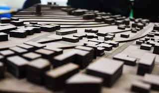
Building the model of the city was very hard due to the steep gradient of the topography. Having the buildings cut into the hill and lining up each layer was crucial. This week we analyses Haifa's urban morphology. By using street view and google earth we were able to make accurate estimates of the heights of the buildings and used this to generate our map.
The information we used to generate the historical map was gathered from a wide range of online journals and books from the library which we used to estimate the urban sprawl.


